|
|
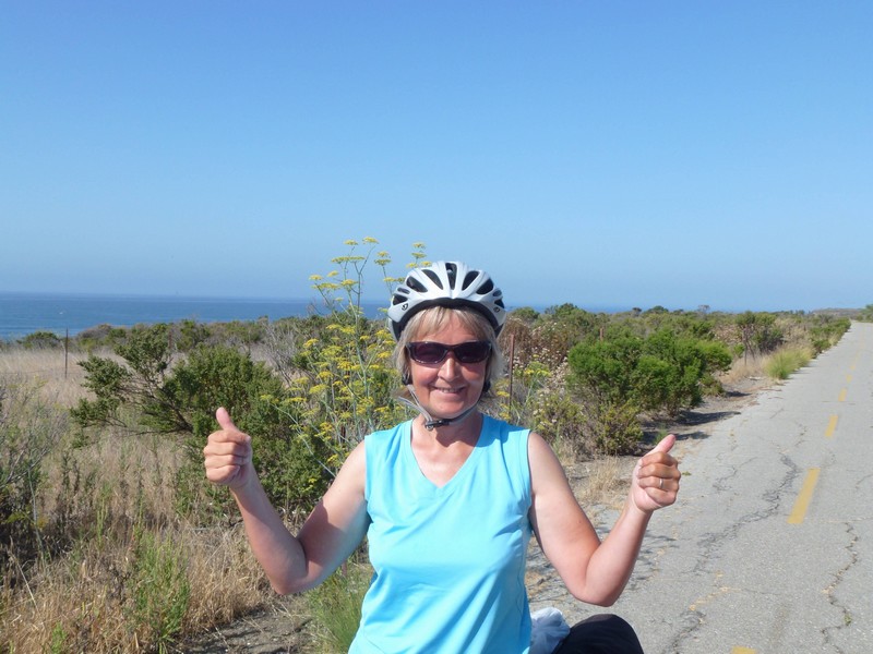
As we leave this morning, heavens there are a lot of cyclists about ! We’re on the route of a 100-mile charity ride. We chat to some of them, the ones who aren’t head down going for it.
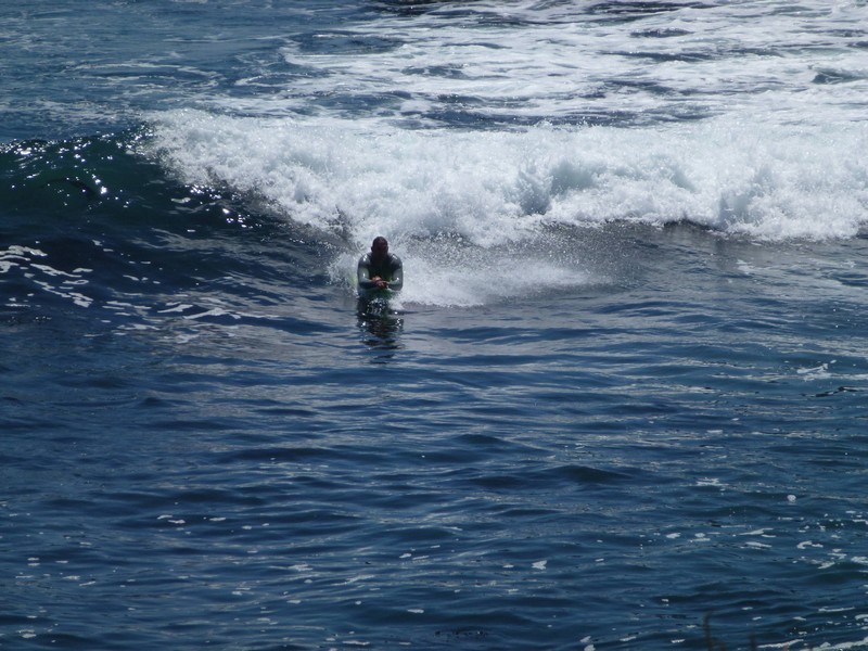
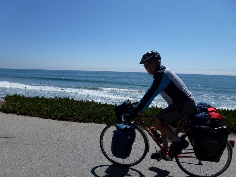
This is surfing country. Everyone has a surfboard on their car. The sea is black with them, but unfortunately it’s summer, so the waves are few and far between.
We lose the cyclists in Ventura, short for San Buenaventura, and home to the Patagonia outdoor gear company, trivia fans, one of my favourites. The local bike path takes us round by the beach and this rock garden, which anyone can help with building.
I don’t know what I’m doing here, really.
We then ride round and round Ventura a couple of times trying to find a cheapish source of sandwiches. Eventually, we seize upon a supermarket outside town, and then hang out at a coffee shop until 3-ish. The State Park won’t let us in until 4 pm officially, but they do anyway at 3:30pm.
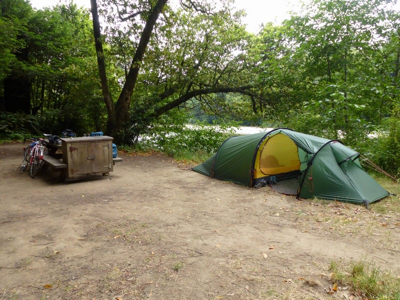
We set up in a nice grassy area, though close to the road and remote from the beach. Diane goes off to explore said strand.
The sands around here, though, contain tar. Not from flushing out tankers, like the beaches north of Liverpool during my youth, but naturally. Diane finds some of this interesting substance, though she isn’t very happy about it.
Most of it comes off eventually! A noisy night ensues thanks to the partying groups around us and the main road. We’re off to Leo Carillo State Beach, the nearest one to Los Angeles, just outside Malibu tomorrow morning.
It’s cloudy again this morning, evidently a rare event in Lompoc. We set off along Highway 1 again, turning up a canyon heading back to the sea. This climbs a thousand feet in about 14 miles, but there’s a hill down at the other end. It’s hot, hot, hot by the time we get there.
We zoom down the hill and rejoin the busy Highway 101, running right by the coast. Our final destination, the Mexican border is about 20 miles beyond San Diego.
After a not particularly interesting ride, we arrive at Refugio State Beach, which is lovely. We set up in hike-bike.
This is within about 20 feet of the beach, possibly the closest we’ve been to the sea.
We have a nice evening chatting to other bikers, drinking beer purchased from the camp store, and listening to the Pacific.
The next morning, Diane is in happy mood. We’re on a bike path to avoid cycling on the freeway.
Unfortunately, the path is closed when we get a couple of miles along it. It’s falling into the sea. We go round the obstacle with a bit of carrying and the like.
We wind up back on the coastal freeway. We’re supposed to exit, but they’re having a few words with the slip road, so the Pacific Coast Bike Route is diverted. Basically, this means staying on the freeway to the next junction.
Eventually, we hit suburbia, and then Santa Barbara, which has a nice bike path.
Eventually, we pop off the end of it and onto a road which parallels the almost stationary freeway, until we reach Carpinteria, where we’ll spend an extra day. They have more muriels here.
We have a nice rest day, mooching about the beach, drinking margaritas and listening to a Johnny Cash tribute act in the local park. We like Carpinteria.
It turns out to be a lovely day in Pismo Beach, which purports to be a “Classic Californian Beach Town”. Our cheapo motel (Motel 6, so called because all the rooms used to be $6: dream on these days) is separated from Pismo by the largest RV park I’ve ever seen. This is only a small part of it.
It has a pier and lots of surfers, as well as tons of wildlife: we see dolphins, shark and pelicans from the pier.
That evening, we head into town to have a meal at Guiseppe’s, a lovely Italian restaurant, recommended by a friend of Diane’s.
After the meal, we walk down to the pier again and watch the sunset and the surfers.
While there, we realize we’re only a couple of weeks away from Mexico. It seems odd that we’ll be at the border in two weeks, and our journey will be over. We’ve got tons of stuff to organize when we get back, so I’ve had to buy a little notebook to start trying to get my life in order in advance. It’s a bit of a change from just getting up, riding, eating, sleeping.
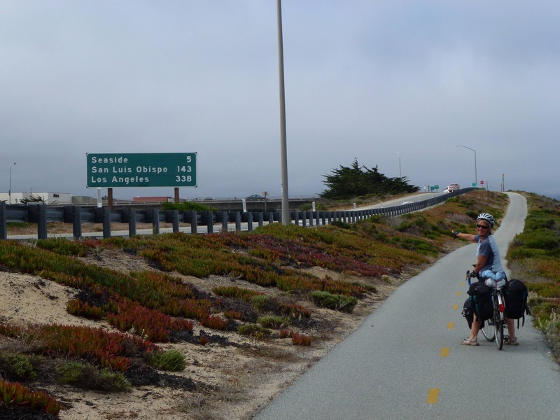
The next morning, we’re off to Lompoc (Lom-poke), where we’re booked into another Motel 6. California is pretty much skint, and so they’ve been closing state parks, or bits thereof. We use their hiker-biker sites, as they are cheap ($5 each per night), and also cannot be reserved, so you can walk into them and be more or less guaranteed a place. Unfortunately, these are being closed to save cash, and the one in Lompoc closed some while ago. Hey ho.
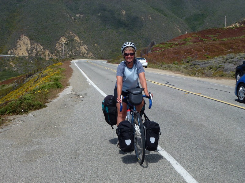
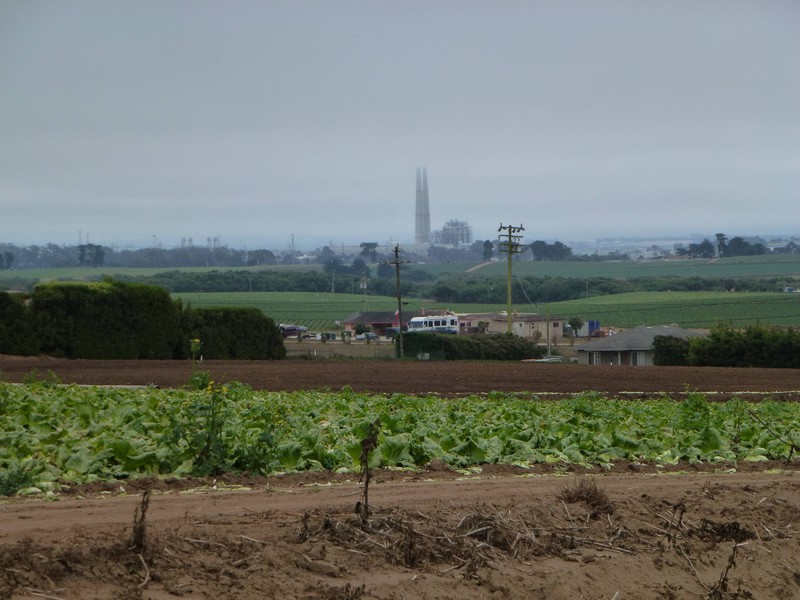
Cold on the coast again, but soon we’re heading inland to avoid Vandenberg Air Force Base, which is bloomin’ huge. We’re back in farming country. Here’s Diane zipping along next to a strawberry field.
This is a very Spanish area of California, and we soon pass through Guadelupe. Here, all the shops have signs in Spanish, and the whole place could actually be in South America. We pass a big mural showing where Guadalupe actually is.
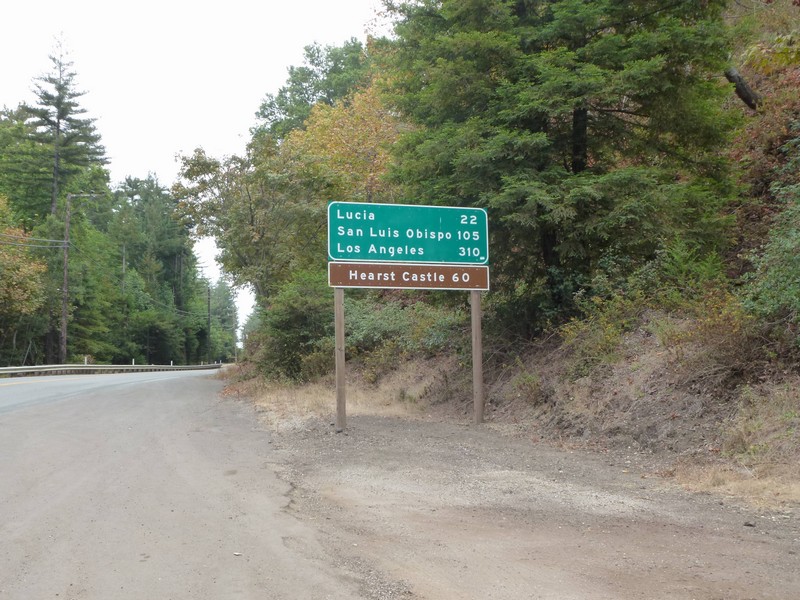
It’s apparently 301 miles to San Diego.
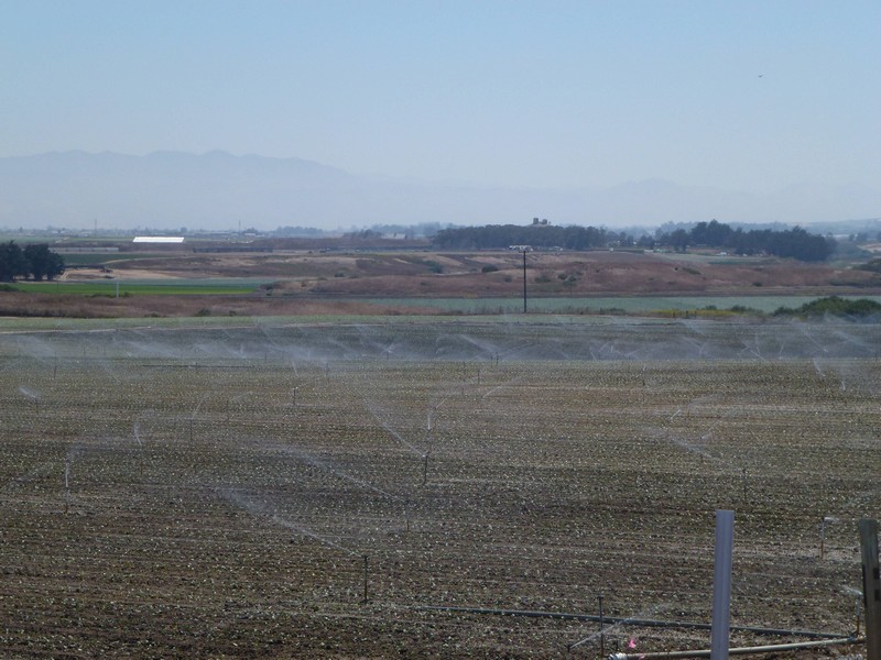
They have to irrigate everything heavily here.
After stopping for lunch in Orcutt, we leave the farmlands and take Harris Grade Road, which climbs 900ft in a couple of miles. After a hot, fly-bothered climb, we arrive at the top, from which we can see Lompoc. It’s still foggy over on the coast by the looks of it. Look, I can see a KFC from here !
Anyway, as someone has pointed out, it’s downhill from here. This seems to have been written by an accompanied tour group called The 3 Amigos, who have been leaving helpful things written on the road for about 10 miles or so (Watch out for cars ! Choo Choo !)
And then we’re in Lompoc. I give the bikes a wipe over, and then we shower and have a Thai meal for a change. Back to the coast (and the tent) tomorrow.
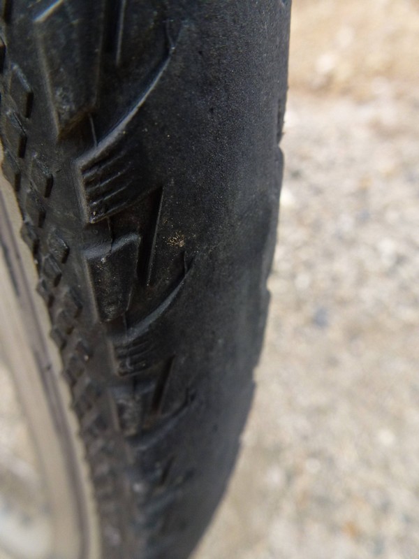
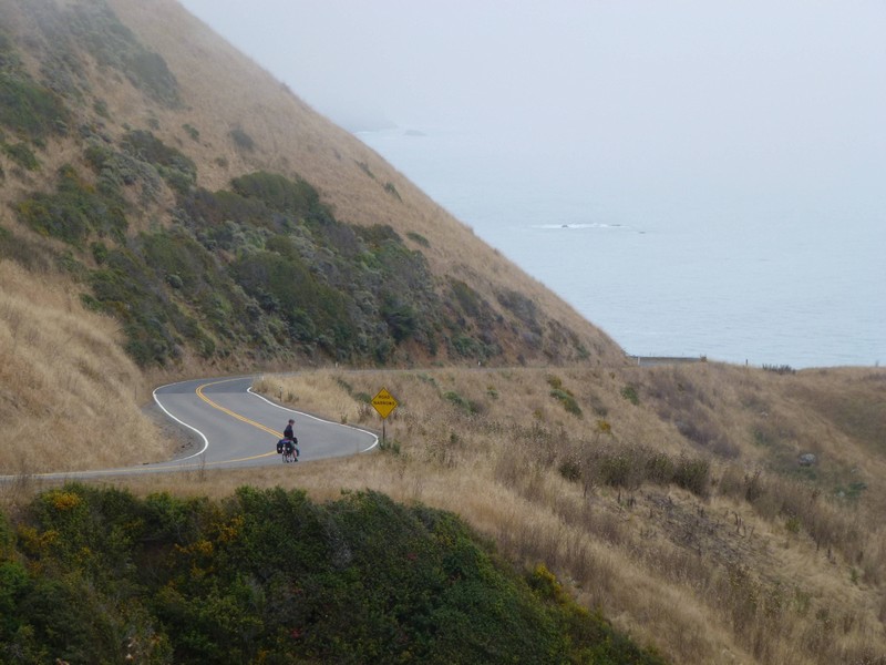
Up and at them to get over the two remaining big hills before the tourist traffic starts. Most of the vehicles on California 1 around here are either RVs, obviously rented because it says so in big letters on the side, or big rental cars containing families who stop at every view point, or middle-aged couples in rented convertibles. It’s handy to have the road to ourselves for a bit.
Anyway, instead of another picture of the coast, here’s a picture of my rear tyre. I noticed during a stop that there’s no tread left on it, and in fact in several places, it’s through the rubber and down to the little metal cords. This, needless to say, isn’t good. It means I’ve worn it out in 1400 miles: it was absolutely new when I rolled out of Vancouver, never been ridden on. I stick a bit of duct tape over the worst parts and hope it doesn’t pop before we hit the flat land again near San Simeon.
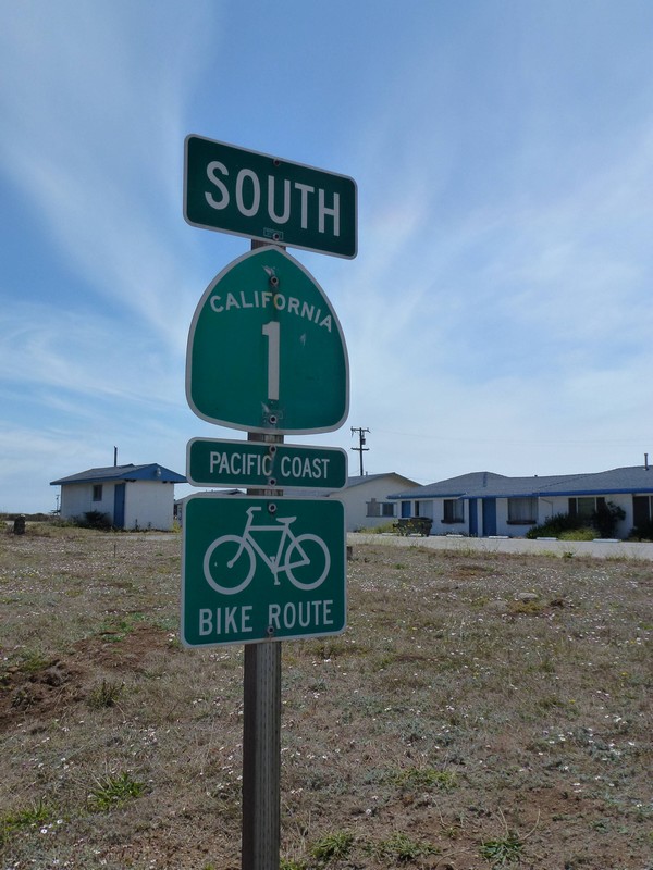
The elusive Pacific Coast Bike Route sign reappears. Haven’t seen one for a couple of days. I’m not sure what they’re for, really. You can’t navigate by them because sometimes they disappear for 75 miles.
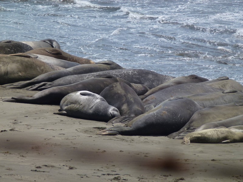
Now we’re on the flat again, there’s long, lovely beaches, and the fog has gone, at least temporarily. On these beaches repose a large colony of elephant seals.
By heck, they pong. Anyway, after that we pass the Hearst Castle, too far away to photograph, built for the newspaper magnate William Randolph Hearst. At San Simeon, we’re in a motel, so I check the interyweb for nearby bike shops and find one in Cambria, four miles down the road. So, the next morning, we head over to Cambria Bike Outfitters to get a new one. (Today, I shall mostly be buying a new tyre).
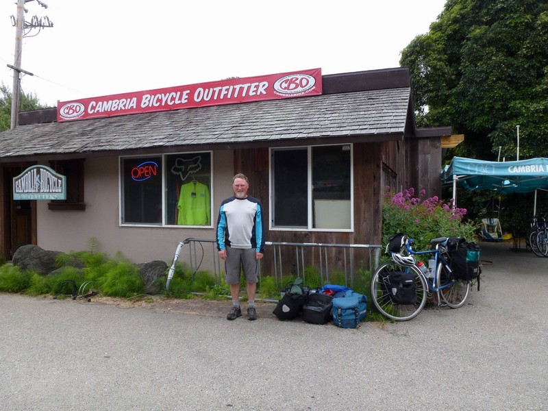
While we were there, I took the opportunity to borrow their track pump and blow up our tyres. Many weeks ago, in Fortuna, I fitted a new tube to Diane’s bike, and the top of the valve broke off. I have left it alone since then, but now it chose to fail catastrophically, so I had to fit a new one. So here’s me, fitting a new tube after the mechanic has finished fitting me a new tyre. During the latter process, we discussed America’s debt crisis. We agreed that the debt thing was not as scary as the utter childishness of most politicians when faced with a crisis. As he put it, they’ve elected a lot of three-year-olds. The UK isn’t much different, I told him.
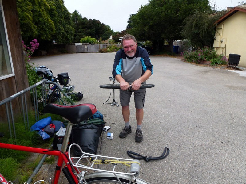
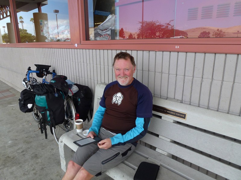
After leaving Cambria, we head over to Morro Bay, our campsite for the night. It’s a short day anyway, just as well after our tyre-purchasing interlude. On the outskirts of the town, we stop at Albertson’s Supermarket, and as is usual, we use their restrooms. Whilst waiting for a coffee, another customer asked me if I knew the store. I said no, not really, but she wanted to know the location of the restrooms. Ah, I said, that’s about the only thing I do know, and told her. Thank you, she said, you have beautiful blue eyes. Ah, I said. So here’s me outside the supermarket with the eyes in question.
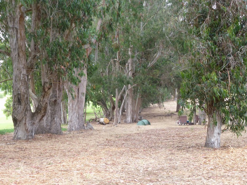
At Morro Bay, we have a lovely site amongst the eucalyptus trees, but by golly, it’s cold. Here we are in Southern California, and we’re still wearing down jackets at 6pm in the evening.
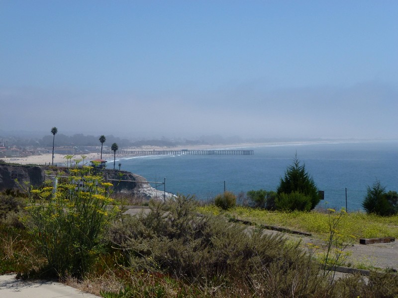
The following morning, it’s no warmer as we set off for Pismo Beach, where we will spend a rest day. Our cooking gas supply packed in last night, so we also need to find an outdoor shop in San Luis Obispo to buy another. It’s hot enough when we get away from the coast, and in SLO it’s cooking. We get the gas, have a spot of lunch, and then head off for Pismo Beach. Eventually, we regain the coast and see Pismo Pier in the distance.
Let’s see what the weather’s like tomorrow !
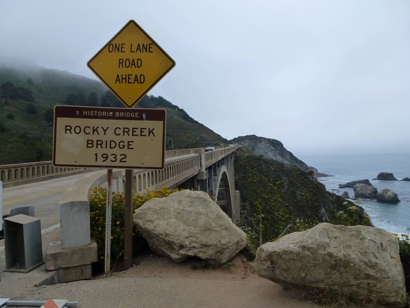
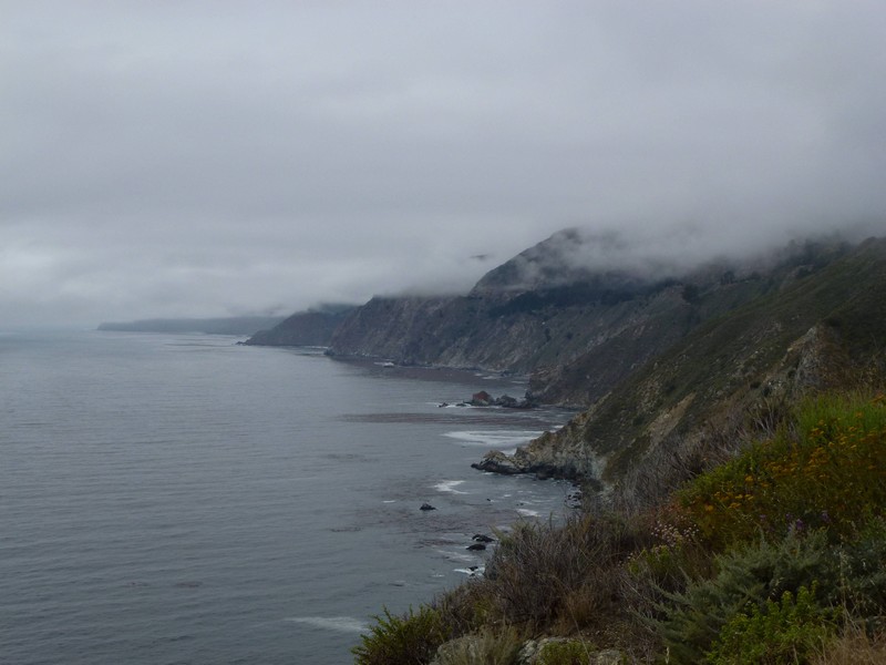
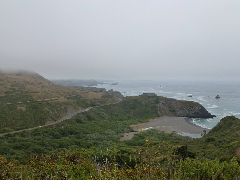
Off we go to Big Sur on another cool and foggy morning. I’d hoped not to have to climb the big hill between Monterey and Carmel, but we’re not allowed on the freeway, so up we go. We eventually ride through Carmel, stop at Safeway to buy food, and then hit the twisty little road to Big Sur. Twisty for 74 miles, apparently.
It’s a narrow road, somewhat careworn. Bits of it are sliding into the sea, so the shoulder is pretty terrible and there’s several sets of road works. There are also a number of spectacular bridges which usually appear in car commercials and tourist promotional literature.
Eventually, as we approach Point Sur itself, the sun comes out. That’s the Point in the distance.
Here’s a picture of Diane looking happy the sun’s out.
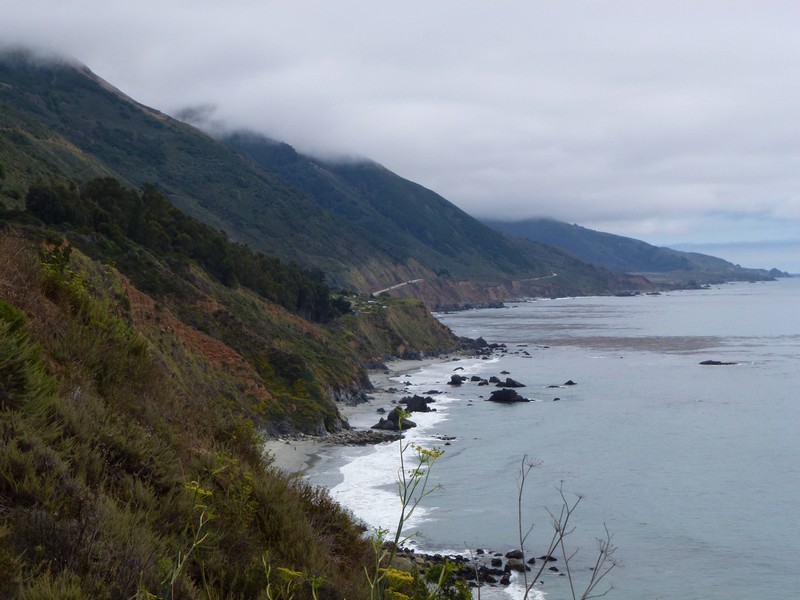
The road moves inland after Point Sur to the small, lengthy town of Big Sur. We stop and buy groceries at the store, and then hit Pfeiffer State Park. This is very plush, with a laundry and a couple of stores, so we stay an extra day, then we’re off to Kirk Creek, another campground which gets great reviews despite having no showers. We start by cycling up a big hill. It’s foggy again. 310 miles to LA.
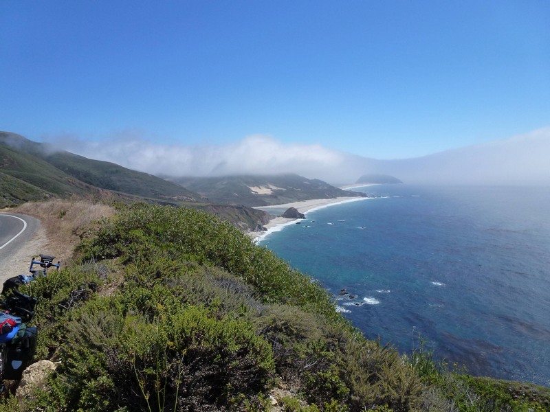
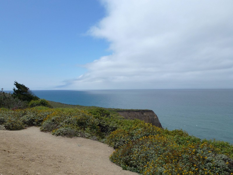
The mysterious Big Sur coast.
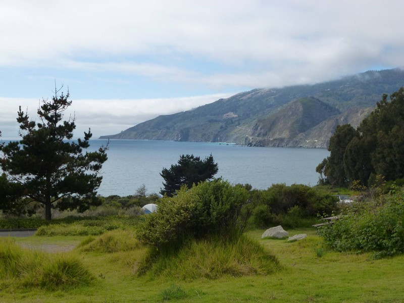
Kirk Creek turns out to be on a small bluff, overlooking the Pacific. It is fabulous, even if there are no showers, and you have to boil the water. We didn’t know the latter, and our gas supply (represented by one very small MSR container which we panic-bought in Garberville, some weeks ago) takes a hammering. That’s it in the middle of the picture (the campground, not our fuel container).
And here it is a bit closer up. Our pitch is near the little tent in the picture.
We pass a pretty blissful evening chatting to other campers, including a few cycle tourists. I fall asleep listening to the sound of the waves breaking on the beach, one of my favourite ways of dropping off. San Simeon tomorrow.
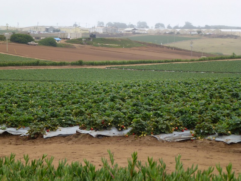
Up bright and early courtesy of being booted out at 9am. This bit of the ride is through miles and miles of fruit farms, mostly strawberries at first, then artichokes. It’s still foggy and cool. These are strawberries.
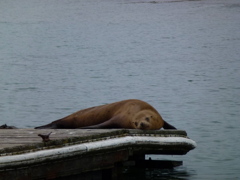
We pass through the town of Moss Landing, chiefly distinguished by it’s power station, obvious for miles.
It’s right on the water, and has a resident population of sea lions.
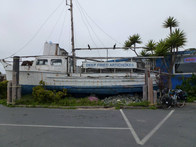
They also deep-fry artichokes here. Why, I’m not sure.
The diner next to it was good, though, we had breakfast there.
The rest of the route was cloudy and cold, so we stopped for the night in a motel in Marina, about 12 miles short of Monterey. We had a Mexican meal, and listened to a chappy play the Jalisco Harp.
So, the morning after the Jalisco Harp we set off for Monterey. We had planned to stay here for a couple of days, as we want to see the Aquarium, and we also have to slow down our journey a bit or we’ll be at the border too early for our flight home. LA is still a ways off, though.
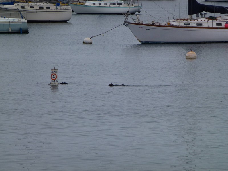
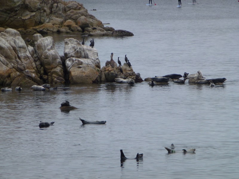
We pitch up in Monterey, and then spend about two hours trying to find a cheapish motel. The following morning, we catch a bus into town and walk round the waterfront. They have sea otters here, as well as sea lions and pelicans, so Diane is in seventh heaven. Here’s a couple of sea otters.
And some seals. Harbour seals, actually, doing their sausage impersonation.
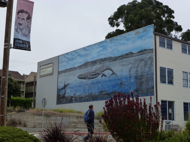
We popped down to Cannery Row, formerly an important canning centre for sardines, anchovies and the like, now an important centre for t-shirts, ice cream and Cannery Row related tat. They also have Muriels, here showing a whale, and also John Steinbeck, who wrote a book called Cannery Row, which apparently gave the place it’s name.
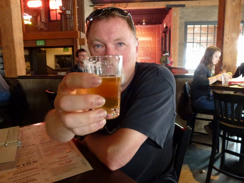
For lunch, we go to the Cannery Row Brewing Company, where they have 73 beers on tap. And very good they are too. I had a number of very small pints, as you can see. (Now concentrate this time, Dougal. These [he points to some plastic cows on the table] are very small; those [pointing at some cows out of the window] are far away. No, I still don’t get it Ted, will I put the kettle on ?)
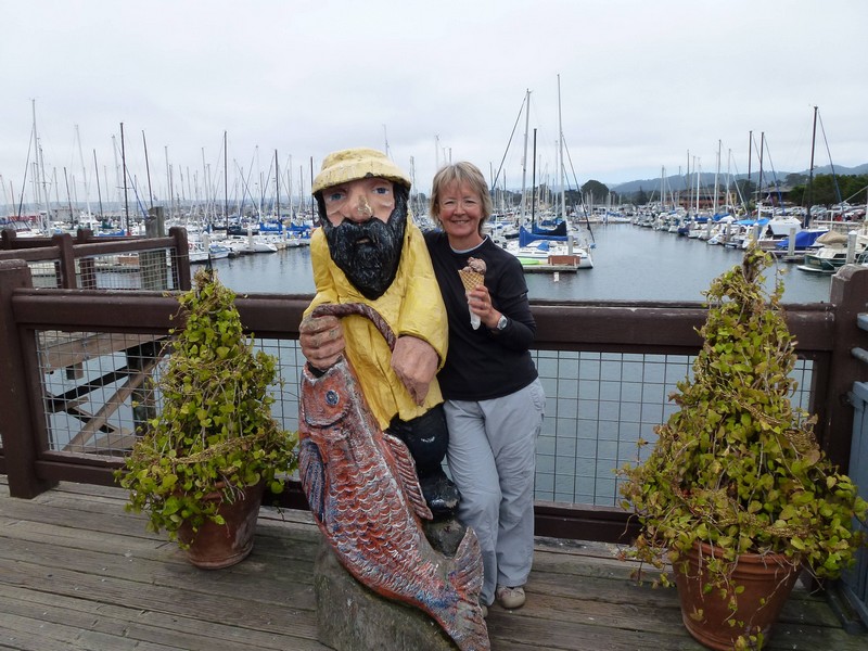
After this, we ambled back to the centre and ate ice cream with Diane’s new friend.
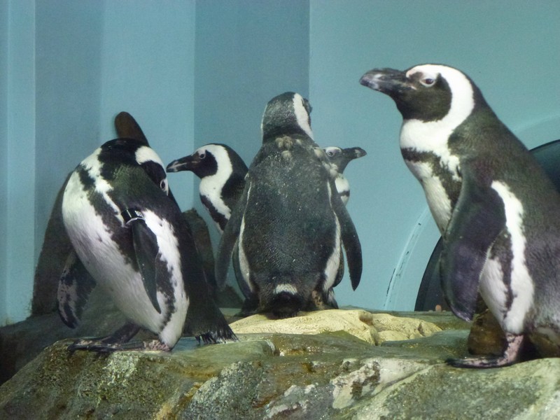
I was keen to see the Aquarium, so we booked on the interyweb that evening (on the advice of the museum staff) and set off early, hoping to catch the feeding of the penguins (another favourite Diane bird) at 10:30. I had always meant to visit when I was an HP employee, as the place had been endowed by David Packard, and HP employees got a discount, but I never had. It’s actually very good, and we spent most of the day there. It was packed. Here’s the penguins: they are the survivors of a mass stranding because a rise in sea temperature caused their food fish to swim north. The penguins followed, and hundreds ended up stranded on beaches because they were too tired to swim any further. Global warming, eh ? Got to love it. I wonder if the guys in the RVs towing full-size Dodge trucks with motorbikes on the back ever visit the Aquarium. Probably can’t find anywhere to park.
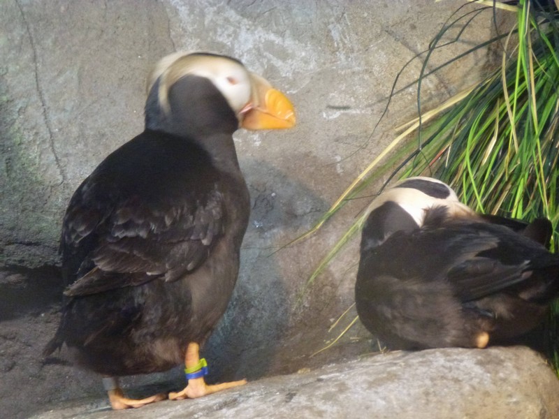
Here’s some puffins also.
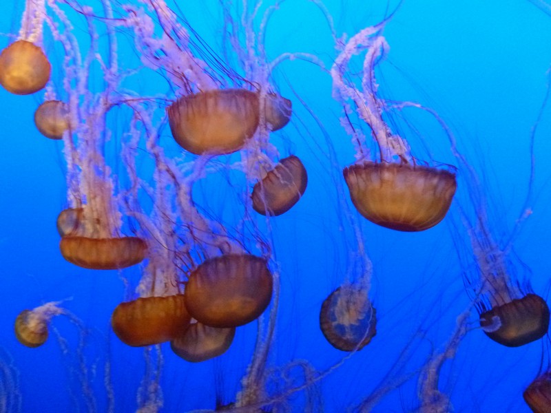
They have an outstanding display of jelly fishes of various sorts.
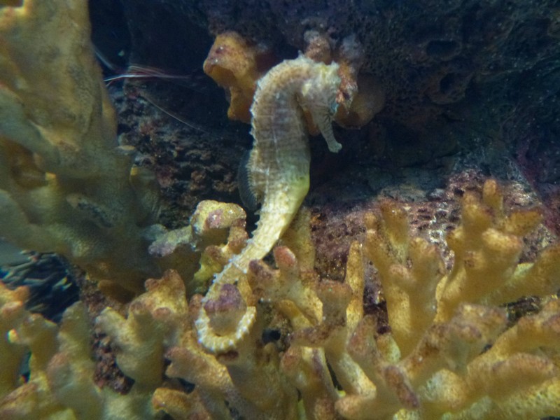
And also of sea horses. Sorry for the blurry photos, but they were in circular tanks.
All in all, a jolly good day. Off to Big Sur tomorrow.
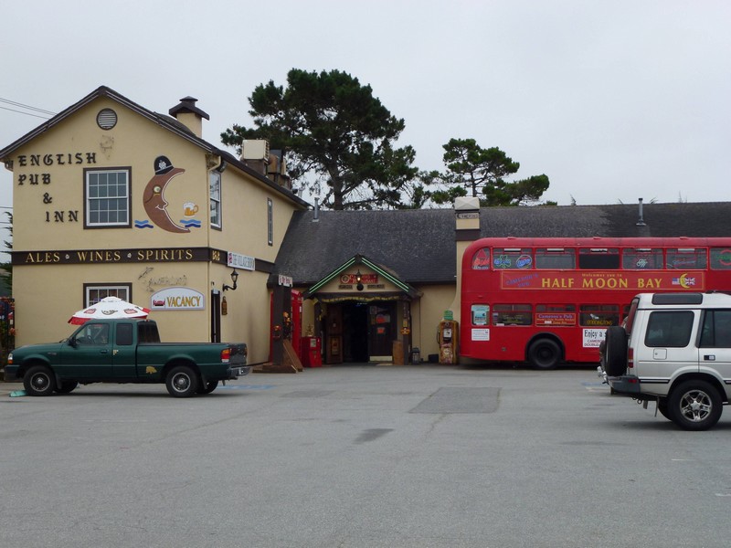
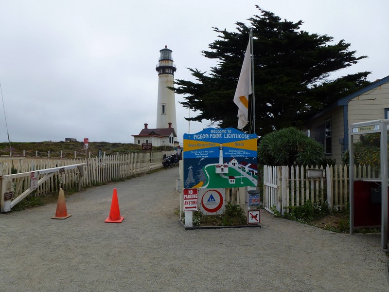
Well, everyone we’ve met has said that we ought to stay at the hostel at Pigeon Point because it’s next to the lighthouse, and it’s nice, so that’s what we’re going to do. This makes for a short day, about 20 miles, so we linger at the campsite and then have breakfast in Half Moon Bay before setting off. Once again, it’s foggy and slightly cold. On the way out of town, we pass this rather bizarre sight.
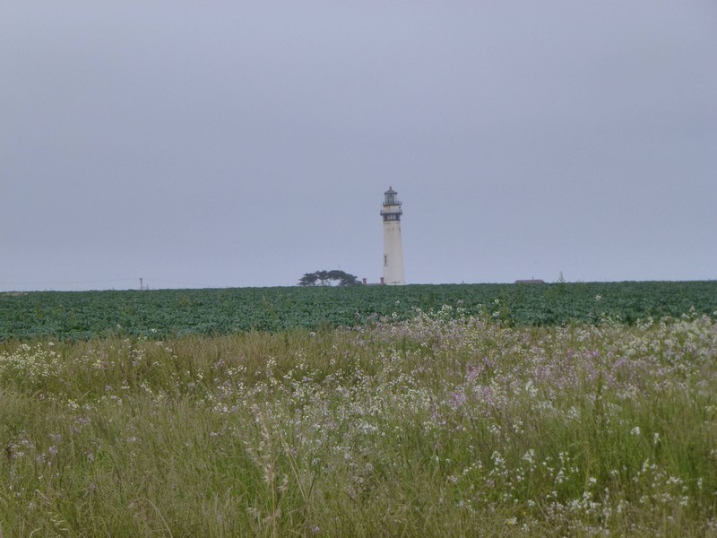
We can’t check in at Pigeon Point until 3:30pm, so we’ve got loads of time. It’s a pretty unremarkable ride, as you can’t really see anything, and it’s basically flat along the coast. Predictably, we haul into Pigeon Point too early, and hang around. Here’s the lighthouse hoving over the horizon.
And it is indeed nice.
Unfortunately, the weather isn’t, being cold, damp and blustery, so we bunker down for the evening and hope it gets better for tomorrow. When we leave, of course, it hasn’t. It remains this way until we cross the Santa Cruz County Line, and then it changes: you can see an actual line in the sky, fog on one side, sun on the other.
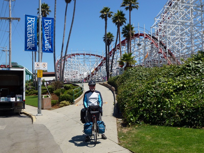
And then we hit Santa Cruz, a biggish college town, surf centre, and seaside resort. Here’s Diane in the sun after looking at pelicans, one of her favourite birds after puffins.
And here’s a picture of a surfer.
The boardwalk, full of seaside fun.
Then, after a certain amount of getting lost, we fetch up at New Brighton State Beach. The biker site here must be afflicted by transients, as you cannot check in until 4pm, you must be in possession of a bike, and you must leave by 9am. It’s nice anyway, with a nice beach.
And here’s some pelicans and a tree. We’re off over Monterey way tomorrow.
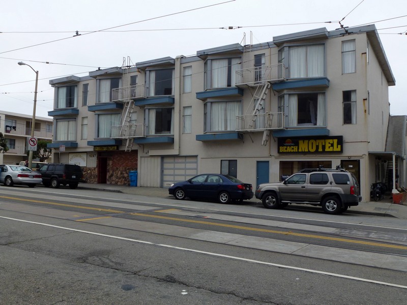
So, we stayed for three nights in San Francisco. We both felt tired, and decided our legs could do with a proper rest. Our motel is about as far out of SF as is possible whilst still being on the Muni: we’re actually at the end of the N line. It’s about a 45 minute journey to downtown, and costs $2. (Hear that, First Group ? TWO DOLLARS. Not £2 to travel a mile and a half from my house to Bath Railway Station. Get a grip.) Here’s a picture of the Beach Motel: note suspicious-looking frontage on the left hand side at ground level: Pittsburgh’s Pub.
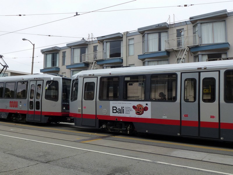
And the ground floor obscured by the Muni. Close, eh ?
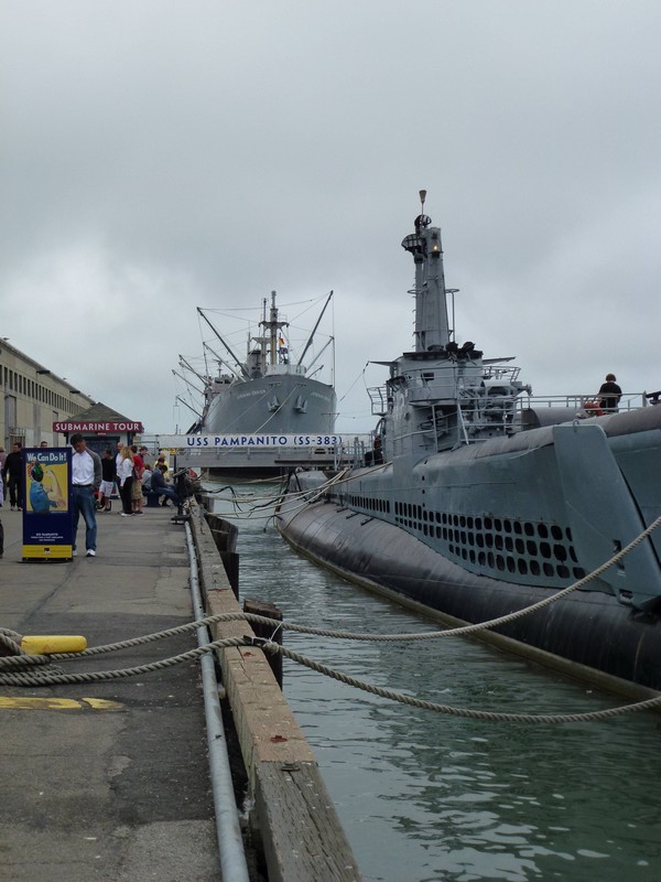
So on the Sunday, we got the Muni downtown, and then walked over to Fisherman’s Wharf. We replaced some gear at Patagonia (one third off in the sale) and then I visited the USS Pampanito, a WW II submarine which is moored there. Blimey, it must have been like living inside a factory devoted to blowing things up. No home comforts at all. (Diane left me to it and went for ice cream!)
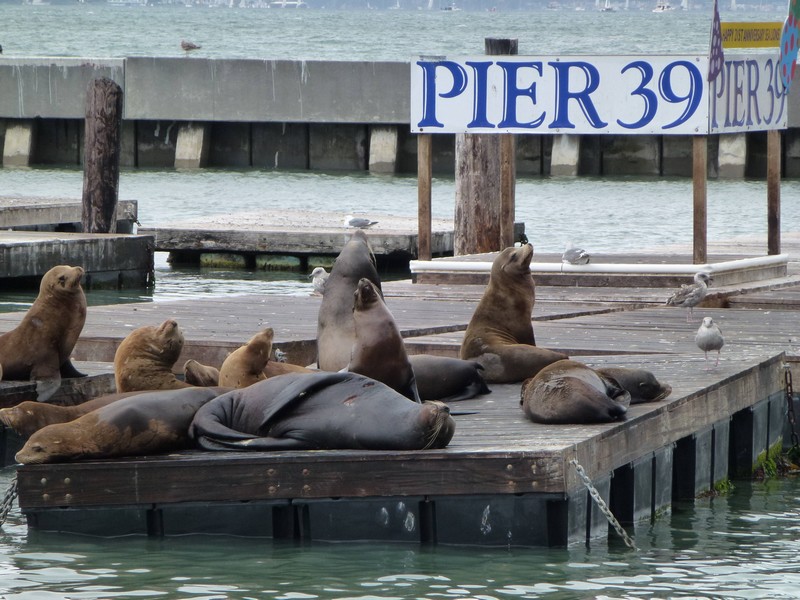
Then Diane took loads of photos of the sea lions at Pier 39.
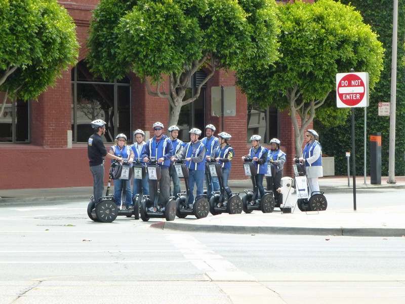
We saw these guys, a Segway tour of SF. Useful for something at last. Then we got the N back to the motel, got an Indian takeaway and watched television (such a novelty these days).
On Monday, we did all our laundry, then got the N to Powell to go to the cinema to see Cowboys and Aliens. This film has no pretensions: it isn’t high art: it’s just a bit of fun. On the way home we stopped for a couple of pints and a pizza, which was so large it provided us with lunch for the following day. On the Tuesday we rode off to Half Moon Bay. I was feeling a bit flat, for a couple of reasons. Firstly, lots of the guys we’d been travelling with had ended their journey in SF, so we’d said a few goodbyes. Then, we’d overdone the celebrations a bit J And finally, our room at the motel was actually over the aforementioned Pittsburgh’s Pub, so sleep, for me, had been fitful at best for the last two nights because of the noise.Anyway, we rode out of San Francisco, and past Pacifica, where I used to fly paragliders in 1994. They’re still flying there, as you can just see in this picture: two gliders are just visible above the higher ridge on the right-hand side of the frame.
Then we rode over the notorious Devil’s Slide, a dire section of road which climbs up and over a bluff. They’re actually building a tunnel through it now, thank heavens.
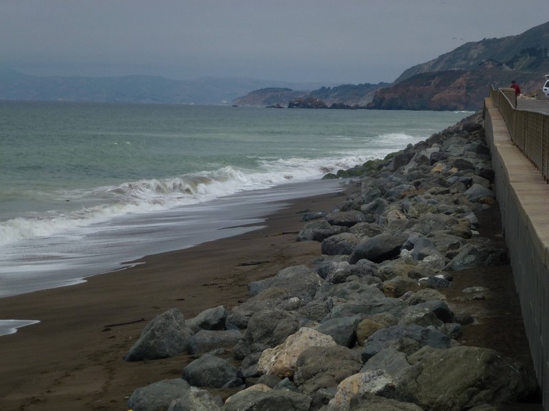
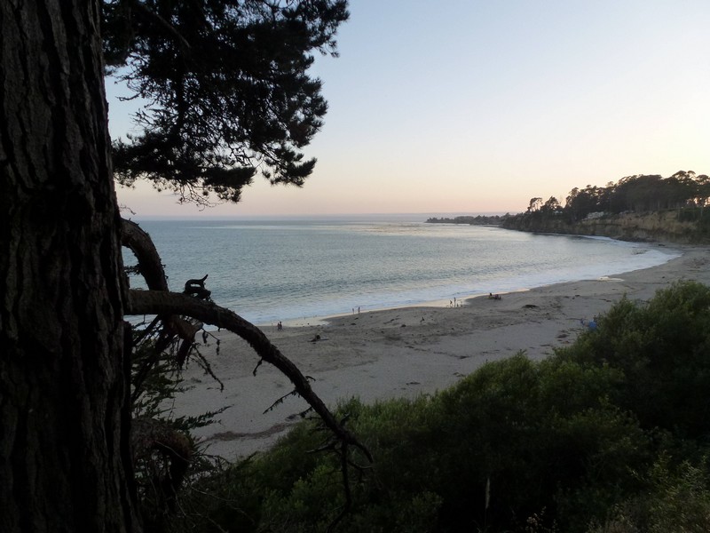
The sun came out at long last and we camped at Half Moon Bay State Park. This is nice, right on the beach.
I’ve just had a crafty kip to try and make up my sleep deficit.
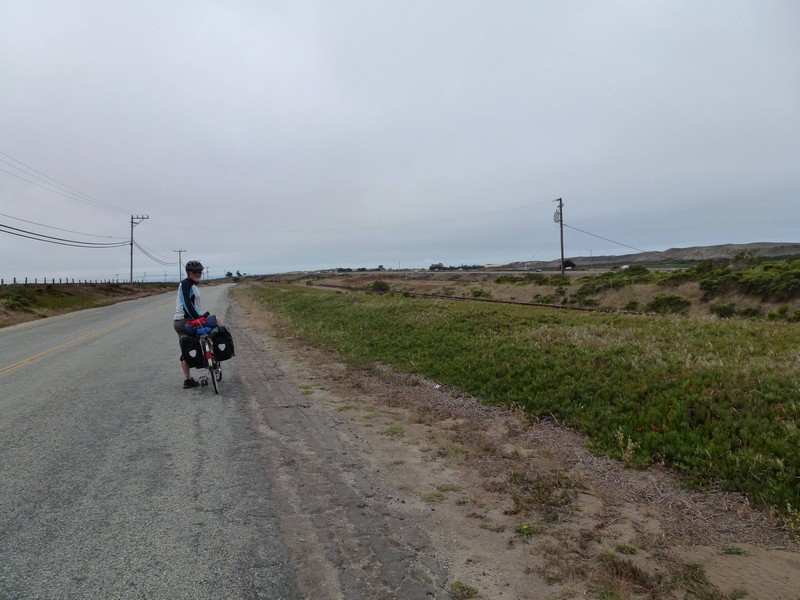
And finally, here’s a shot Diane took while riding along, without falling off ! Way to go !
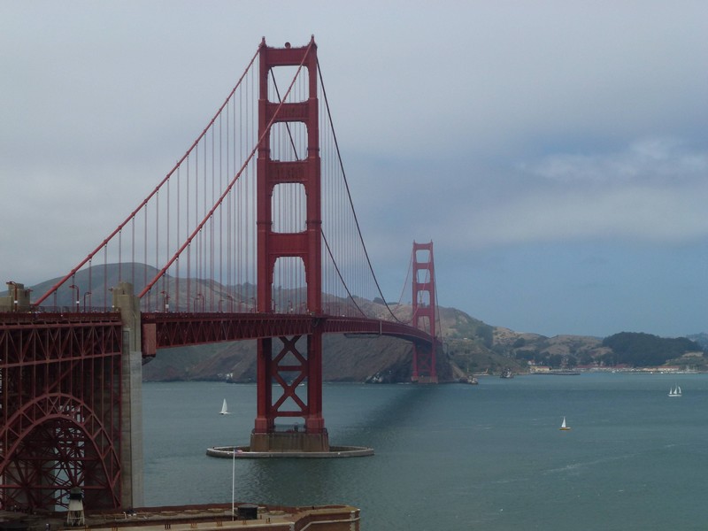
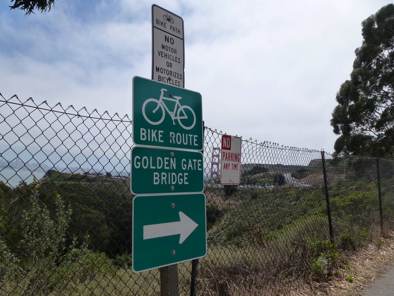
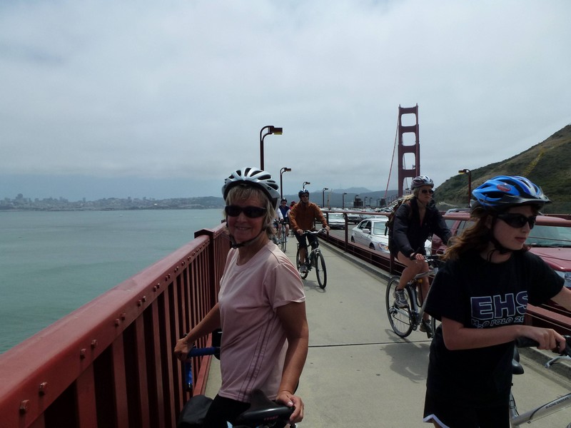
OK, let’s get it over with. Here it is. The Golden Gate Bridge after we’ve cycled over it, 1240 miles after leaving Vancouver. Looks nice, doesn’t it ?
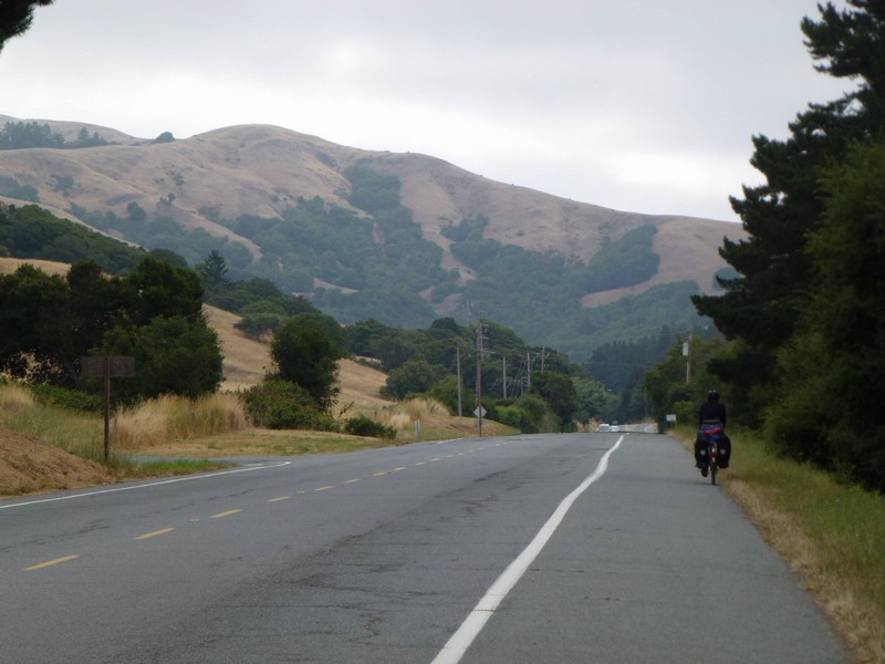
Anyway, we pulled out of the campground at about 8:15 and rode down towards Fairfax for breakfast. It’s a Saturday morning, so there aren’t many vehicles on the road, but there are hundreds of road bikes. These are serious lycra-clad roadies: a few nod or say hi, but most just ride past heads down, discussing their latest carbon frame with a colleague. Initially, we thought that there was a race on, but no, it’s just an average weekend day apparently. Anyway, here’s a photo without any of them in, riding down the valley towards Sausalito.
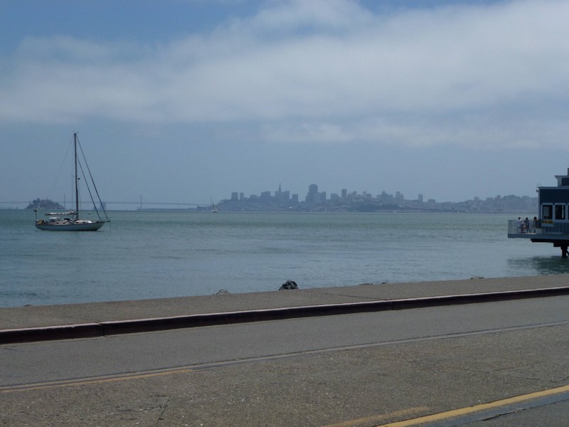
We’re in suburbia now, so there’s no problem finding our way, which is well signposted, and also covered in cyclists. Eventually, we pop out in Sausalito, with San Fran just visible in the background. We stop at Mike’s Bikes to buy some brake blocks, and the guy there says, kind of seriously, that the bridge will be busy.
Sausalito is a nice little place, although also super-busy. The latest thing, we surmise, is to rent a bike in San Fran, cycle over the bridge and then get the ferry back, thus avoiding cycling up the flamin’ big hill which the builders of the Golden Gate saw fit to put the thing on. We, however, have to go up it.
Up and up we go, until we reach the parking lot at the Marin end of the bridge.
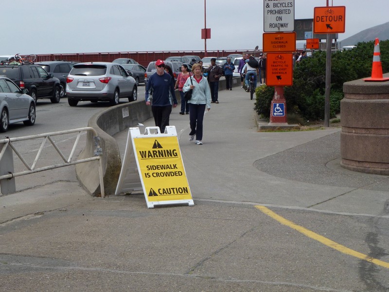
And then we’re there, cycling over the bridge. I had expected to ride onto the Bridge, look at the cityscape, and think, blimey, 1240 miles. Maybe take a few photos. Savour the moment. But no. Actually riding over the bridge was an unpleasant experience, akin to riding your bike down the pavement in Oxford Street on the last Saturday before Christmas. One walkway was closed, so all the traffic was on one side, and that was narrowed for bridge works. So, thousands of people walking, roadies on carbon fibre bikes, tourists wobbling about on their hire bikes all mixing it, going in both directions on the same walkway. Inevitably, someone ran into me, though fortunately without damage. Here’s Diane keeping her cool.
Anyway, they had a little sign at the other end. No kidding.
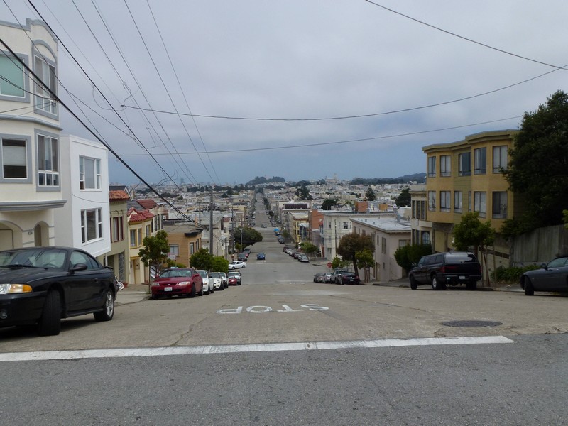
We’re happy, anyway. It’s a major milestone arriving here, and we’re going to have a few days off to rest. We cycle through San Francisco on mostly deserted streets to our motel, which is in Ocean Beach, near Golden Gate Park.
It’s a busy old weekend in San Fran, as it’s the annual marathon tomorrow, although this starts at 5:30am, so we’re unlikely to see it. We walk into a restaurant 100 yards from our motel, to find it’s a high-end Vietnamese. We have a marvellous meal to celebrate arriving.
Another multi-day post. Apologies, but wifi is hard to come by in the remoter bits of Northern California ! Anyway, this is a monster four-day post as we approach San Francisco.
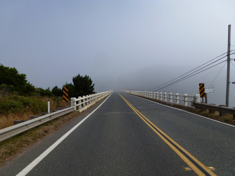
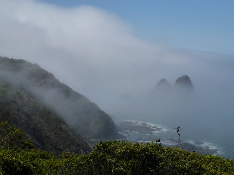
It’s a foggy, cold day as we leave Van Damme. There are a lot of bridges to nowhere this morning.
The fog lifts slowly, and the scenery gets better.
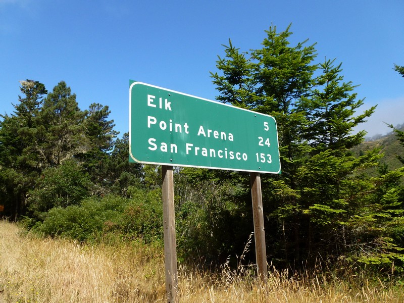
San Francisco gets closer, and there’s now actually a town called Elk ! Still no live examples, though.
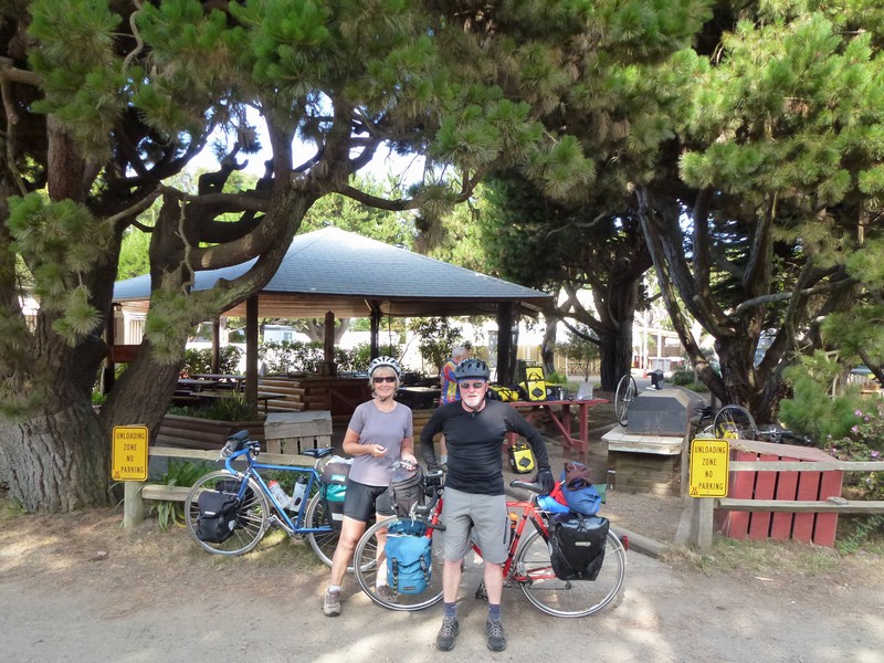
The day remains largely cool and windy, though, and eventually we haul into the KOA at Manchester Beach. We were considering the state park, but it has no showers, so lots of tourists end up here. We have a very convivial evening chatting to other cyclists, cooking in the campers kitchen, eating ice cream and sitting round the communal camp fire. Most are ending their trip in San Fran, so we’ll probably see them again.
Next morning, we swap names and emails and take photos before heading off to Gualala. The bike in the background has a snapped spoke on the rear wheel, which is being repaired with a kevlar spoke. Interesting device, and it did the trick, as I watched the bike ride over the Golden Gate a couple of days later.
After a fairly uneventful ride, we pull into Gualala, where we buy groceries. I am feeling a bit under the weather, so we bunker down at the campsite for the afternoon and then eat sandwiches for dinner, all I can manage. This proves to be a mistake J The site is nice, next to a river, and pretty quiet during the week. The hiker-biker area is a bit small for our tent, so we take an empty normal camping slot. The ranger, though, lets us have it for the hiker-biker rate, $5 each, as they’re not even remotely full.
Next morning, we’re off to Bodega Dunes campground. Not eating properly yesterday takes it’s toll, and I’m a bit weak and watery. We grind along until we stop to chat to a support vehicle for a supported cycling group. The guide is very generous, and gives us Oreos, Clif bars and various energy goo thingies, which perk me up no end. Just as well, really, as the route is very hilly.
This was a true alpine-style climb and descent, switchbacks and all.
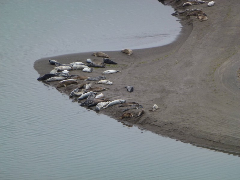
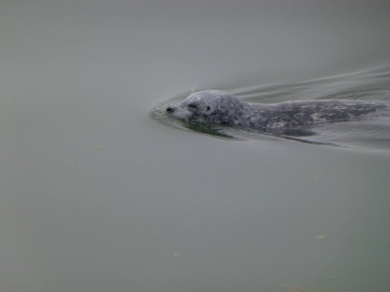
On the way, we cross the Russian River, where a load of seals hang out.
And finally, we arrive at Bodega Dunes campground. This is a very nice, sandy hiker-biker, and we meet up with some of the guys from Manchester. After pitching we ride into Bodega Bay, have very good fish and chips, and buy some beer. We chat relatively late into the night.
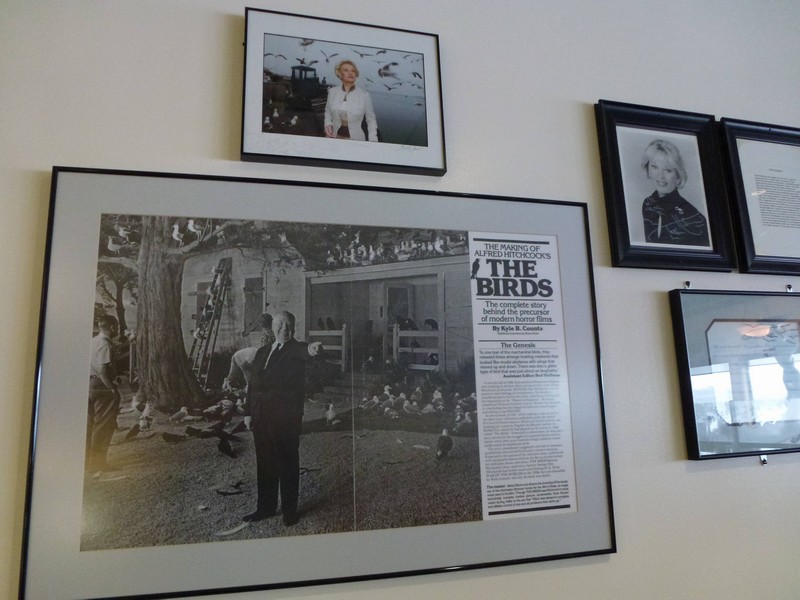
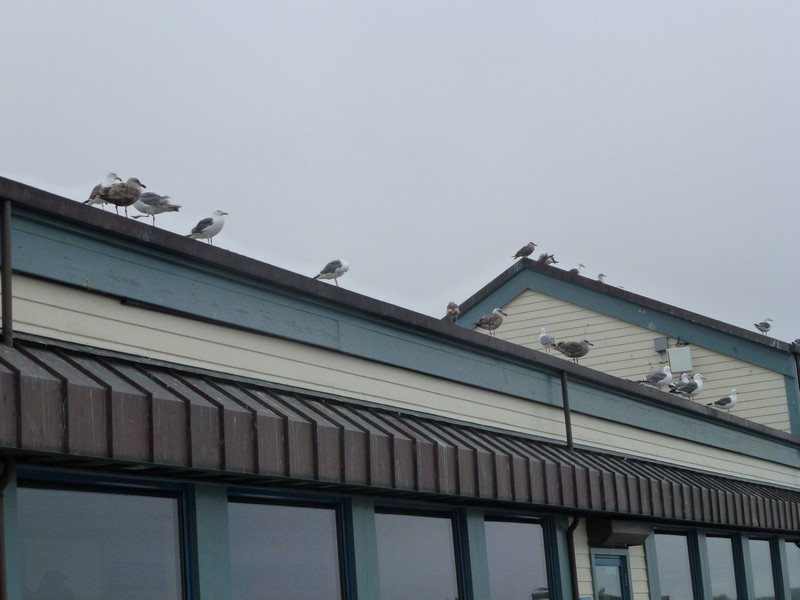
The following morning, we’re off the Samuel P Taylor State Park, our last stop before San Fran. We stop in Bodega Bay for breakfast, at The Tides. This is a rather plush hotel and restaurant complex which replaces the original Tides from the film The Birds, which burnt down in 1968. They have tons of memorabilia on display, and the breakfast was good.
It’s right on the water, and lots of wildlife swims and flaps past.
Wonder if these were extras in the film who never got over it ?
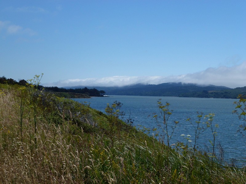
Anyway, it’s a lovely ride to Sam Taylor, along Tomales Bay.
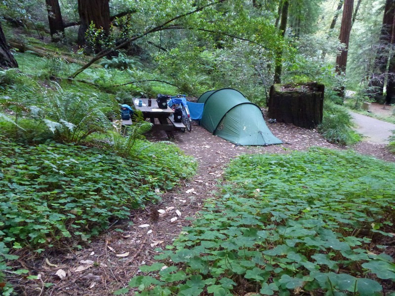
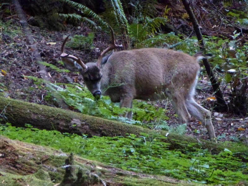
We set up at Sam Taylor, and again meet up with some guys from last night. We all eat all the food we have so we don’t have to carry it any further, which makes for interesting meals.
While I’m having a shower, a deer appears behind our tent and Diane takes a photo of it.
To bed early. Our plan is to get up and away early doors, and arrive in San Francisco early afternoon. Exciting !
|
|


Recent Comments